Você está na versão anterior do website do ISA
Atenção
Essa é a versão antiga do site do ISA que ficou no ar até março de 2022. As informações institucionais aqui contidas podem estar desatualizadas. Acesse https://www.socioambiental.org para a versão atual.
Rise in deforestation and fires may worsen Covid-19 crisis in the Xingu
Wednesday, 03 de June de 2020 
Crossing the cattle
Conservation Units under pressure
Esta notícia está associada ao Programa:
More than 20 thousand hectares were deforested in the Xingu river basin between March and April. Fires may intensify the overload on health systems in the region, already affected by the new coronavirus pandemic
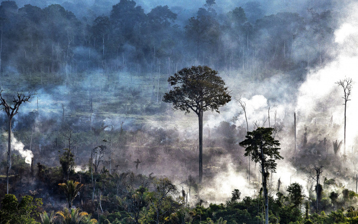
In only two months, 20,859 hectares were deforested in the Xingu river basin, the equivalent to the falling of 25 million trees between March and April. The illegal mining boom and the advancement of Covid-19 pandemic in Pará and Mato Grosso, states that form the basin, put indigenous and traditional peoples who live there in danger.
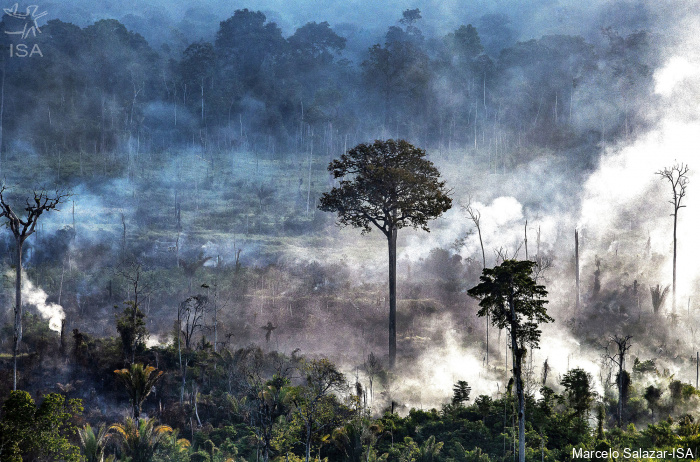
With the end of the rainy season in the Brazilian Amazon, deforestation tends to increase and, consequently, forest fires. This scenario may aggravate the health conditions in the region, already affected by the dissemination of the new coronavirus over the country. In total, 202 deaths and 8,257 cases confirmed in the 53 municipalities neighbouring Xingu’s Protected Areas, according to epidemiological reports from June 16th.
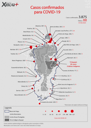
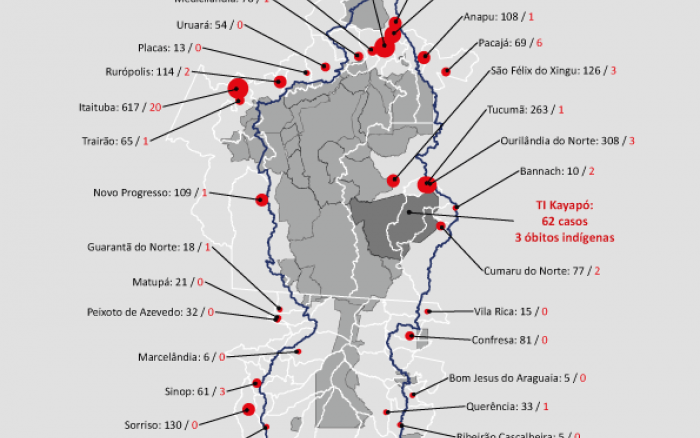
Three indigenous from the Kayapó people died last week of Covid-19 in the Kayapó Indigenous Land (IL), the first notified deaths inside an IL in the basin. There are already 62 cases in five villages, according to the Kayapó Special Indigenous Sanitary District (Dsei), which still counts 11 suspected cases and 111 notifications under analysis.
According to the National Institute for Space Research (INPE), between August 2019 and May 2020, 78,4 thousand fire spots were detected in the Amazon, a quantity higher than the same period in 2018-2019, when 65,3 thousand fire spots were registered. In April alone, the number of active fires (4,117) was the highest since the beginning of the historical series, in 1998. “It is evident that the intensification of the deforestation process, observed this year, will result directly in more fires in the Amazon in 2020”, says the technical note.
[Read the full note]
“The expectations, following the long-term pattern, is that if there is not an incisive State intervention to restrain illegal actions, these fires will induce the increase in particulate matter emitted into the atmosphere, degrading air quality and, consequently, increasing the incidence of respiratory diseases in the Amazonian population”, says the note.
The institute also warns that if the turning point of the epidemiological curve of the new coronavirus does not occur immediately, there will be an overlap of the peak of the pandemic with the burning season, between August and October, which will put the country “in a state of vulnerability never experienced before”. This is explained by the increase in the demand for treatment in hospitals and health units, further burdening health systems.
“Planning is crucial to minimize the impacts before the problem occurs. It is necessary to use intelligence information to fight deforestation, we already have the technology to identify the areas, focuses and regions that need immediate action. In addition, a second moment of investigation of the causes that lead to deforestation is needed: who are the great agents behind it”.
“We, Brazilians, need to understand that public lands are ours, the people’s. If there is invasion of a public land all of us are being stolen. This mature understanding of the public good is a matter of education, citizenship”, completes Anderson.
Crossing the cattle
After Ibama’s command and control operations in Indigenous Lands in the south of Pará, deforestation rates in Cachoeira Seca, Apyterewa, Ituna Itatá and Trincheira Bacajá Indigenous Lands had a significant drop. These four ILs are on the most deforested lands ranking in the Xingu basin and the Amazon in 2019.
In March and April, ILs Apyterewa and Trincheira Bacajá had 40% and 49% drops, respectively, compared to the same period 2019. In IL Ituna Itatá, deforestation dropped to zero in the second bimester of the year.
In spite of the tendency of decrease in illegal deforestation, the coordinators responsible for the operatinos, Renê Luiz de Oliveira e Hugo Loss, were dismissed from their positions in early April.
“The recent layoffs send a clear message: organized crime is allowed in the Amazon and anyone who works to combat illegal activities will be punished. The coordinators responsible for the operations were dismissed. Why removing them at the moment they were fighting illegal deforestation in Indigenous Lands?” considers Ricardo Abad, ISA remote sensing expert.
Abad reaffirms that illegal deforestation now represents a double threat “with dissemination of Covid-19 throughout the country, besides destroying the forest, invaders can contaminate indigenous and traditional peoples”.
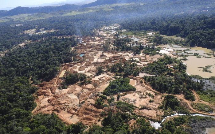
Illegal mining boom in the IL Kayapó
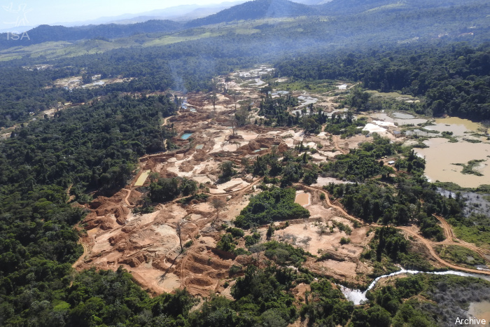
With 502 hectares deforested in the first four months of 2020, 170 ha in April alone, the Kayapó Indigenous Lands faces the increase in illegal mining.
The IL is among the Protected Areas with the oldest prospector activities, beginning in the early 80’s. From 2015 on, illegal mining accelerated, mainly in its northeast limit, on the banks of Branco river. Until today, more than 11 thousand hectares have been deforested in the Kayapó Indigenous Land, causing irreparable damage to the environment and the indigenous.
In 2019 alone, more than 1,7 thousand hectares were deforested due to illegal mining, which is coming closer to the villages. After a year without surveillance, a field operation took place in the north of the IL in April, a little before the Ibama’s surveillance coordinators layoffs. The uncertainty of the continuity of effective actions to combat illegal activity concerns indigenous peoples and partners.
Conservation Units under pressure
In March and April, deforestation in the APA Triunfo do Xingu rose again, concentrating 90% o all the deforestation in Conservation Units in the basin. In total, there were 4,718 hectares of forest loss, a 57% increase compared to the same period in 2019. Last year the APA was the deforestation champion among all the Protected Areas in Brazil, with approximately 35 thousand hectares of forest destroyed.
The Altamira National Forest (Flona) also registered a deforestation rise, with 516 ha of forest loss in the second bimester of the year, 231% more than the two previous months. Besides two illegal mining fronts located in the west and northwest of its territory, illegal invasions continue to operate in the southern portion of the Protected Area
The data is from the 18th Sirad X Report, the near real-time deforestation radar monitoring system of the Xingu + Network, an articulation among indigenous and riverine people, and their partners who live and work in the Xingu river basin.
Isabel Harari
ISA
Imagens:


