Você está na versão anterior do website do ISA
Atenção
Essa é a versão antiga do site do ISA que ficou no ar até março de 2022. As informações institucionais aqui contidas podem estar desatualizadas. Acesse https://www.socioambiental.org para a versão atual.
Deforestation advances on Indigenous Lands impacted by Belo Monte Hydroelectric Plant
quarta-feira, 23 de Dezembro de 2020 
Belo Monte debt
Pressure increases in Conservation Units
Xingu Basin leads deforestation ranking
Esta notícia está associada ao Programa:
The Apyterewa, Cachoeira Seca, Ituna Itatá and Trincheira Bacajá ILs, in Pará State, lead the ranking of the most deforested in the Amazon; invasions increased after the cancellation of Ibama's operations in May
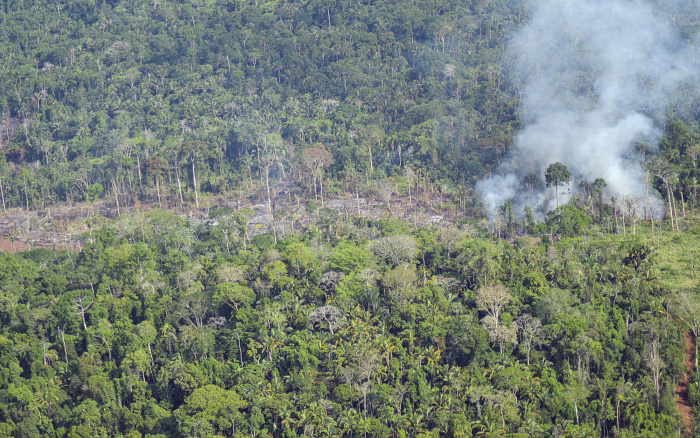
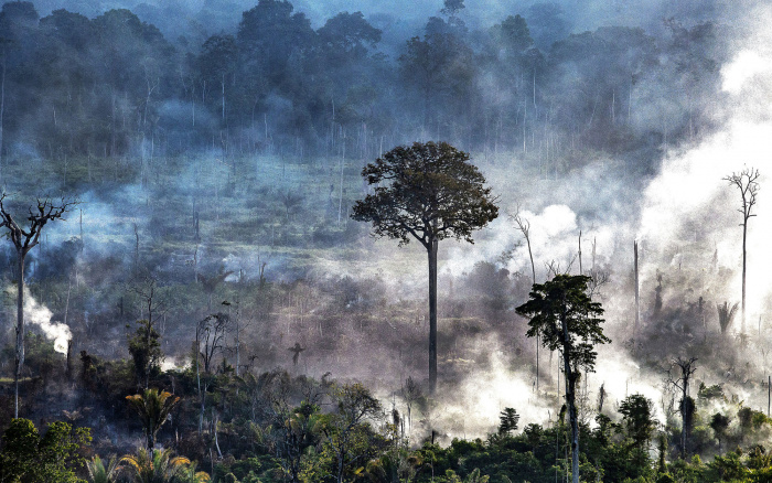
In just two months, September and October, 5.4 thousand hectares were deforested in the Cachoeira Seca, Apyterewa, Ituna Itatá, and Trincheira Bacajá Indigenous Lands, in Para State. Located in the area of influence of Belo Monte Hydroelectric plant, the four ILs are the most deforested in the Amazon, according to Prodes data. [Find out more in the box below]
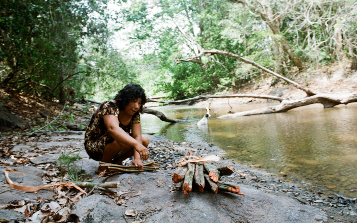
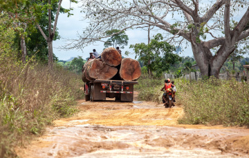
The structuring of a territorial protection plan and land tenure regularization are conditions that should have preceded the construction of the plant, in 2011, and they have not materialized to date. Five years after the Operating License, indigenous people denounce an increase in invasions of their territories, aggravated by the spread of the Covid-19 pandemic. “We demand that the monitoring, inspection and protection actions be resumed. The forest does not only matter to us indigenous peoples, it matters to all people on the planet ”, says a manifesto signed by the Parakanã, Arara, and Xikrin peoples on November 24th. [Read in Portuguese].
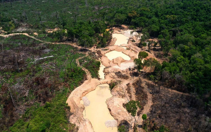
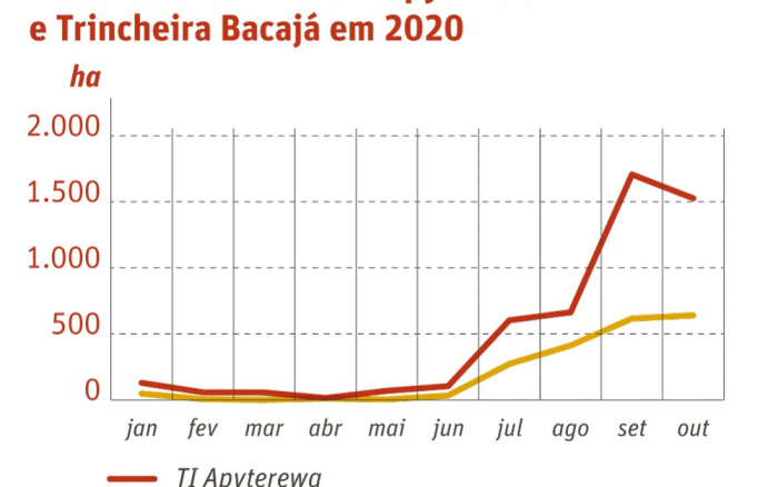
Apyterewa concentrated 51% of deforestation in ILs in the Xingu basin between September and October. The invasions have been driven by a land-grabbing scheme in which new invaders are installed irregularly by land grabbers within its boundaries, and two active illegal mining fronts intensify the pressure on the territory.
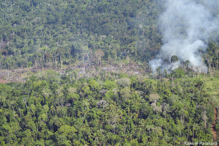
Deforestation in Apyterewa exploded after the cancellation of Ibama's inspection actions, which had been fighting the forest destruction until May this year. There was an increase of 393% in the month following the suspension of operations, which continued to grow uninterruptedly until November, when Ibama operations were resumed within the IL. Between July and August, 1,200 hectares were deforested, and another 3,200 hectares in September and October, according to data from Sirad X.
Located in the area of influence of Belo Monte, Apyterewa faced increased pressure in 2018, when 1,800 hectares were cleared, 334% more than in the previous year. In 2019, the number quadrupled, reaching the mark of 8.6 thousand hectares.
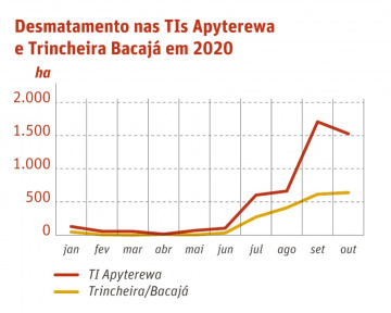
As in Apyterewa, deforestation in Trincheira Bacajá IL exploded after the end of Ibama's operations. From 3 hectares deforested in May, deforestation jumped to 640 hectares in October. Despite the request for the removal of invaders in the IL, one of the emergency measures requested in the claim of non-compliance with fundamental precept (ADPF) submitted by the Articulation of Indigenous Peoples of Brazil (Apib) to the Supreme Federal Court, deforestation continues to increase: 1.2 thousand hectares have been cleared between September and October, an increase of 84% compared to the previous two months. [Know more]
“We want answers, we want to know why Operation Verde Brasil 2, which started in May this year, has not prevented the continuation of illegal actions in our territories. What has been done to protect our forests and our families? ”,the indigenous people ask in the letter.
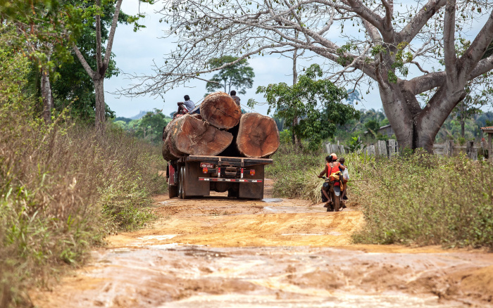
In the text, the indigenous people demand effective measures to contain threats to their territories, such as the removal of invaders, the installation of barriers at the entrance to protected areas, the seizure of illegal cattle, the destruction of buildings and the seizure of equipment used in illegal activities.
The data are from the 21st Sirad X bulletin, the deforestation monitoring system of the Xingu + Network, an articulation of indigenous, riverine and partners in the Xingu basin.
Belo Monte debt
The land regularization of the ILs in the Belo Monte area of influence and the implementation of the Territorial Protection Plan are old debts of the hydroelectric plant, which should have been paid off before the installation of the plant, in 2011. Despite the determination, the Operating License was granted in 2015. The absence of protection measures for Indigenous Lands explains part of the growing threats and pressures in the territories.
The protection of ILs against pressures was a priority action in the design of conditions and socio-environmental programs. [Read ISA’s Technical Note in Portuguese]
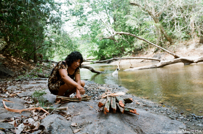
“Today what we see is the opposite of what had been promised: a large increase in organized movements of invaders that threaten us and threaten our families. The invaders are motivated by government promises to reduce our traditional territories and by the reduction of inspection actions ”, the indigenous people say in the letter sent to the Federal Public Ministry in November.
The issuance of the Operating License was made possible through the signing of a Cooperation Agreement between Norte Energia, the plant's concessionaire, and Funai for the implementation of the Territorial Protection Plan for Indigenous Lands impacted by Belo Monte. Five years later, and even after being judicialized by the MPF, the plan remains incomplete: of the eight Territorial Protection Units agreed upon, three have not been built yet.
Two of them, the Cachoeira Seca Operative Base and the Rio das Pedras Surveillance Post should have been implemented in Cachoeira Seca, which has been leading the deforestation ranking for six years (Prodes). The other one, a surveillance post, should have been built in Ituna Itatá IL, which also ranks among the most deforested ILs in the Amazon. In these two Indigenous Lands, no base has yet begun to be built.
Since 2015 the company justifies that it has not advanced in the works because it cannot guarantee the safety of its employees. In response to a request for access to information made by ISA, Funai states that “it has repeatedly demanded agility in the process, having enabled security support by official public security forces, however Norte Energia has not yet presented a construction schedule for the pending works”. Until the closing of the text, however, Norte Energia did not present a construction schedule for the pending works.
In early November, the Federal Court of the 1st Region ordered the Union and Funai to complete the land regularization processes for the Paquiçamba and Cachoeira Seca ILs, in Pará State. The agencies have 90 days to present a work schedule, which includes demarcation, homologation and removal of invaders from the territories. In case of non-compliance with the deadlines, the government must pay a fine of R$ 10 thousand reais for each day of delay. [Know more]
Pressure increases in Conservation Units
More than 12 thousand ha were deforested in Conservation Units in September and October, an increase of 37% over the previous two months. The Triunfo do Xingu Environmental Protection Area (APA), in Pará, concentrated ¾ of all deforestation in CUs, with 9,500 hectares of forest destroyed in the period. Even with a history of land grabbing, the APA remains without a management plan and without areas defined as priorities for conservation.
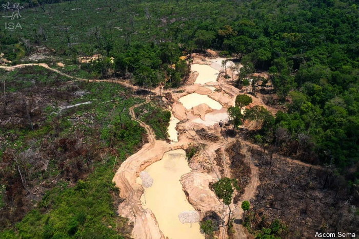
For the 12th consecutive year, APA leads the ranking of the most deforested CUs in Brazil, according to Prodes, with 43.86 thousand hectares of forest destroyed. Deforestation puts pressure on neighboring Protected Areas such as the Ecological Station (Esec) Terra do Meio and the National Park (Parna) Serra do Pardo, both of which are strict protection Conservation Units under the responsibility of the federal government.
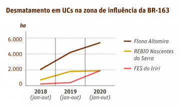
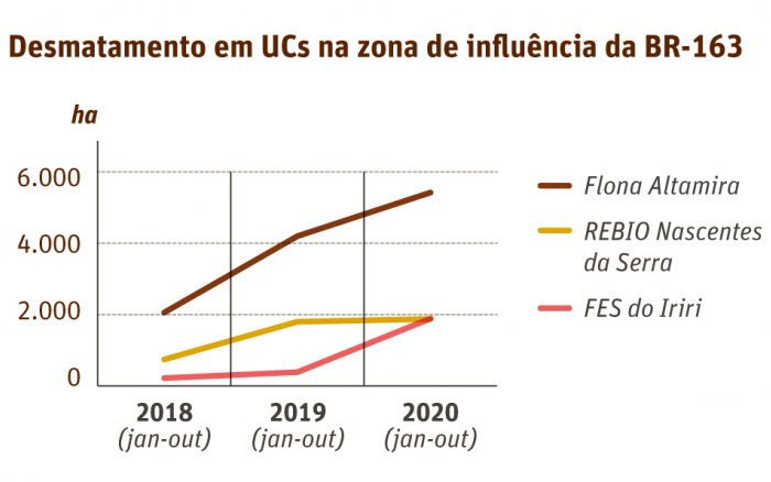
Following the APA Triunfo do Xingu, the three most deforested PAs in the period are located in the area of influence of BR-163 road, which has already consolidated itself as a vector of pressure on Protected Areas. The National Forest (Flona) of Altamira, the Biological Reserve (Rebio) Nascentes da Serra do Cachimbo and the State Forest (Fes) of Iriri, located around the road, accounted for 1 thousand hectares, 670 hectares and 403 hectares deforested between September and October, respectively.
Xingu Basin leads deforestation ranking
The Xingu basin concentrated the four most deforested Indigenous Lands in the Amazon and the most deforested Conservation Unit in Brazil for the 12th consecutive year, the APA Triunfo do Xingu. The data are from the Deforestation Monitoring Program of the Brazilian Amazon Forest by Satellite (Prodes) of the National Institute for Space Research (Inpe), and correspond to the period between August 2019 and July 2020.
In the basin, deforestation jumped from 227 thousand to 255 thousand hectares in 2020. Of this total, 74% occurred in the Pará portion of the basin, which also affects the state of Mato Grosso. More than half of the deforestation occurred in areas outside Conservation Units, Indigenous Lands and rural Settlements.
Deforestation in ILs in Xingu increased by 12.5% compared to the last period. Cachoeira Seca leads the ranking with 7.3 thousand hectares deforested, followed by Apyterewa(6.3 thousand ha), Ituna / Itatá (6.2 thousand ha) and Trincheira / Bacajá (2.3 thousand ha). IL Kayapó, which accounted for 1,600 hectares of destroyed forest, ranked sixth on the list, behind IL Mundurucu, located in the Tapajós river basin.
The leading APA Triunfo do Xingu deforested over 43,000 deforested hectares, equivalent to the urban area of Manaus, the capital of Amazonas State. Among the 13 CUs mapped in Xingu, eight showed an increase in deforestation rates: deforestation in the Iriri State Forest and the Altamira National Forest grew 331% and 196%, respectively.
Isabel Harari
ISA
Imagens:
Arquivos:
| Anexo | Tamanho |
|---|---|
| 284.78 KB | |
| 437.05 KB | |
| 1.94 MB | |
| 6.76 MB |


